Arctic ocean floor
carta politica e dei fondi oceanici scala 1:10.140.000 cm.79x51
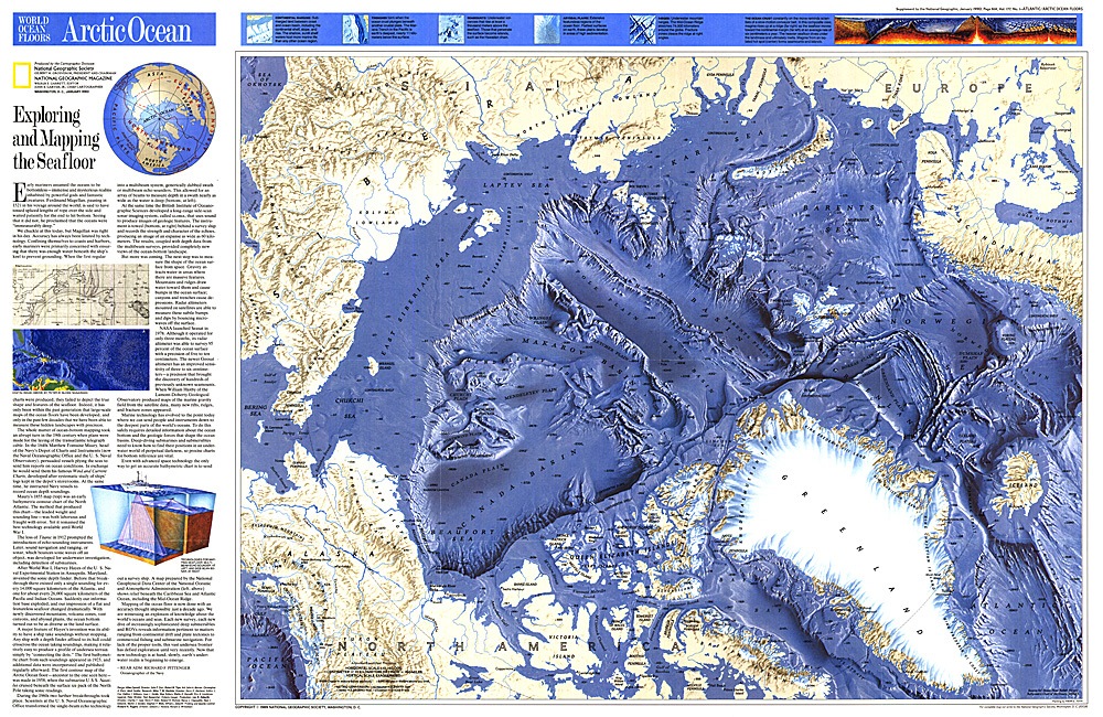
Arctic ocean floor
carta politica e dei fondi oceanici scala 1:10.140.000 cm.79x51
- Disponibile in 7 giorni
- Possibilità di reso entro 10 giorni lavorativi
- Transazione sicura con carta di credito, Paypal o bonifico bancario
- Spedizione tracciata con SDA
See the relief of the seabed of the Arctic Ocean on this stunning map. National Geographic published this map in January 1990, almost a year after the American flag tanker "Exxon Valdez" ran aground off Alaska and caused an oil spill. About 37,000 tons of crude oil leaked, contaminating the 2,000 kilometers of coastline. This and a map of the Atlantic ocean floor accompanied the article "Alaska's Big Spill - Can the Wilderness Heal". Included on this map is an article by Rear Admiral Richard F. Pittenger, Navy oceanographer, explaining the technology behind the amazing cartography. You can also discover striking details of the Arctic soil, for example fracture zones, the continental shelf, basins, plains and plateaus, ridges, sea depths and much more.