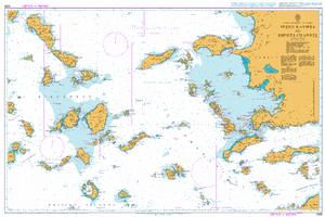
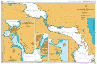
Evvoikos Kolpos
Golfo di Eubea
Carta Nautica Evvoikos Kolpos
Golfo di Eubea
- Disponibile in 48 ore
- Possibilità di reso entro 10 giorni lavorativi
- Transazione sicura con carta di credito, Paypal o bonifico bancario
- Spedizione tracciata con SDA
in plastica scala 1:149.000 From O. Kárystos up to Tríkeri channel. Includes: North and South Evvoikos Gulf, Maliakós Gulf, coast of east Évvoia except Kymi. Larger scale charts included in the back side: Rafína harbour; Évripos strait and Chalkída harbour; Erétria approaches and harbour; Ágios Konstantínos and Kaména Voúrla harbour; Loutrá Aidipsoú and Límni harbour; Lichádes islets; Stylída channel and harbour; Glyfa harbour.