ionian Sea charts
Carta Nautica ionian Sea charts
- Disponibile in 7 giorni
- Possibilità di reso entro 10 giorni lavorativi
- Transazione sicura con carta di credito, Paypal o bonifico bancario
- Spedizione tracciata con SDA
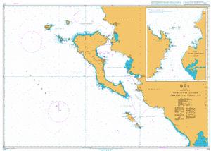
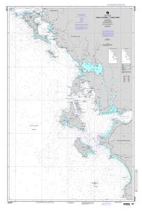
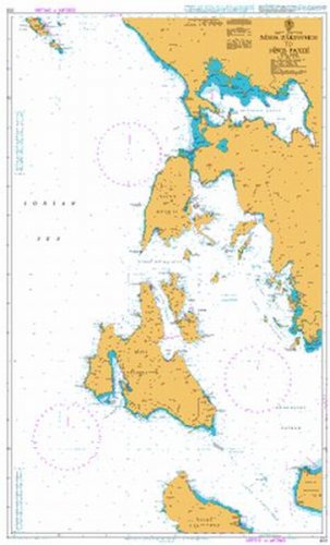
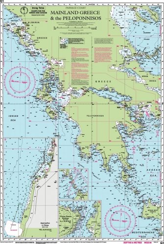
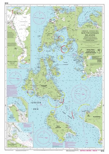
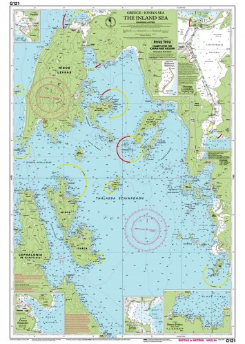
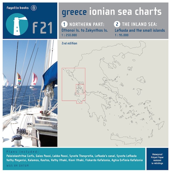
The publication of a completely up to date double-sided map of the Ionian sea region. The first side depicts the XE21 map by the HSHN, originally printed in 2002, including all the vital mariner information up to June 2012. The region, being reproduced at 1:250.000, scale includes all the Diapontia islands north of Corfu all the way down to the northern part of Zakynthos. The highly sophisticated design of the map offers unmatchable clarity and enhanced information detail. On the second side of the map we can see the Inland Sea, on a 1:95000 scale which includes Lefkada and the small islands as well as the Northern part of Kefalonia and a big section of Ithaki. The complete edition is supplemented with accurate representation of the following ports: Paliokastritsa Corfu, Gaios Paxoi, Lakka Paxoi, Syvota Thesprotia, Lefkada's canal, Vathy Meganisi, Kalamos, Vathy Ithaki, Kioni Ithaki, Fiskardo Kefalonia, Aghia Evfimia Kefalonia. Additionally aerial view of the Lefkada canal on a 1:20.000 scale, which includes all the available nautical information, and a detailed part of Lefkada canal up to Preveza significantly adds to the usefulness of the map.