Mediterraneo nella cartografia ottomana
coste, porti, isole, negli atlanti di Piri Reis
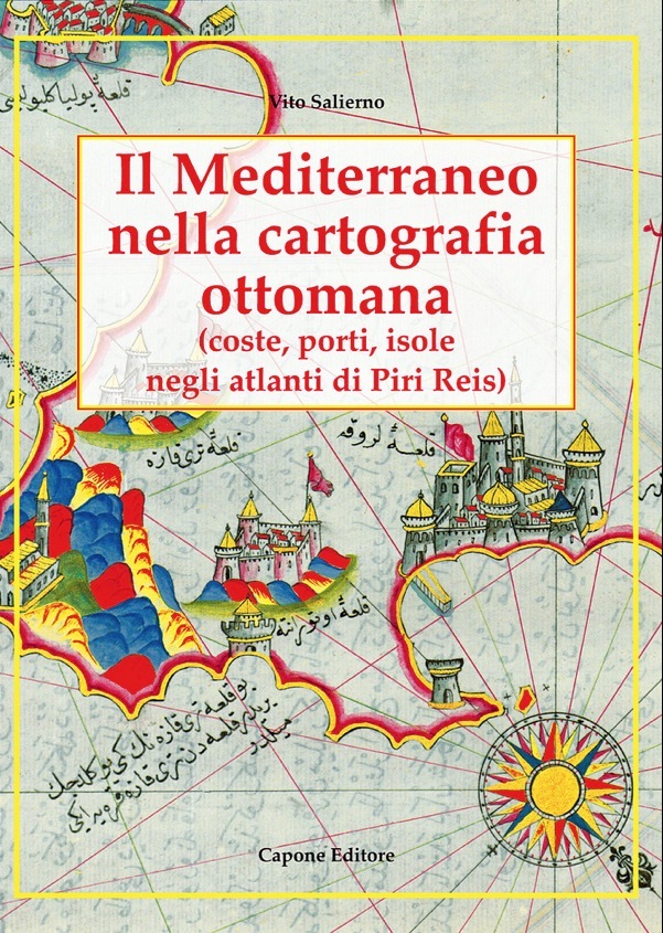
Mediterraneo nella cartografia ottomana
coste, porti, isole, negli atlanti di Piri Reis
- Disponibile in 48 ore
- Possibilità di reso entro 10 giorni lavorativi
- Transazione sicura con carta di credito, Paypal o bonifico bancario
- Spedizione tracciata con SDA
La cartografia islamica del Mediterraneo non è mai stata studiata nel suo complesso, anche se sono stati pubblicati molti importanti saggi e articoli, in particolare su mappe singole e sugli atlanti compilati da Piri Reis, l’ammiraglio della flotta ottomana nel Cinquecento, che fu autore di due versioni del Kitab-ï Bahriyye [Il libro del mare], copiato ampiamente per tutto il XVII secolo. Il libro, di derivazione dagli isolari italiani, era rivolto all’uomo di mare nella sua prima versione, al collezionista e al bibliofilo nella sua seconda versione: di qui il successo dei molti manoscritti, decine dei quali si conservano tuttora. L’analisi della cartografia islamica va dalla Geografia di Tolomeo, le mappe di Ibn Idrisi e le esistenti carte medievali sino all’opera di Piri Reis e dei suoi successori quali Nasuh Matrakçi, Seyyid Nuh, Katib Çelebi, e i cosiddetti atlanti di Hümayun e ‘Ali Macar. Ampio spazio è stato dedicato alle descrizioni delle mappe di Piri Reis: coste, porti, isole dell’Italia, Francia, Spagna, paesi del Maghreb, Egitto, Grecia, Turchia, e isole principali nel Mediterraneo. The Islamic Cartography of the Mediterranean has never been studied on its whole complex, even though many qualified essays and articles have been published, in particular on single maps and on the atlases compiled by Piri Reis, the 16th c. admiral of the Ottoman fleet, who was the author of two versions of the Kitab-ï Bahriyye [The Book of the Sea], which was copied extensively in the 17th century. This book, closely derived from Italian isolari, was directed to the mariner in its first version, to the collector and book amateur in its second version: hence the success of the many manuscripts, tens of which are still extant. - The analysis of the Islamic cartography goes from Tolomeus’ Geography, the maps of Ibn Idrisi and the extant Middle-age charts to the work by Piri Reis and his followers such as Nasuh Matrakçi, Seyyid Nuh, Katib Çelebi, and the so-called Hümayun’s and ‘Ali Macar’s atlases. Much space has been devoted to the descriptions of the maps by Piri Reis: coasts, ports, isles of Italy, France, Spain, the Maghreb countries, Egypt, Greece, Turkey, and the main isles in the Mediterranean.