North circumpolar region - region circumpolaire Nord
scale 1:9.000.000 cm.120x101
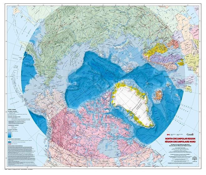
North circumpolar region - region circumpolaire Nord
scale 1:9.000.000 cm.120x101
- Disponibile in 7 giorni
- Possibilità di reso entro 10 giorni lavorativi
- Transazione sicura con carta di credito, Paypal o bonifico bancario
- Spedizione tracciata con SDA
This bilingual map at a scale of 1:9.000.000 shows the geography of the northern circumpolar region, north of approximately 55 degrees latitude. The map uses the azimuthal equidistant projection. All international boundaries, as well as the Canadian provincial and territorial boundaries and Canada's 200 nautical mile offshore exclusive economic zone are displayed on the map. National capital cities, other cities, towns, villages and hamlets along with some seasonally populated places are also shown. The map identifies a number of significant northern features, including the median sea ice extent from September 1981 to 2010, the tree line, undersea relief, land relief, the Magnetic North Pole, glaciers, ice fields and coastal ice shelves. Many of the physiographic and hydrographic features are also labelled.