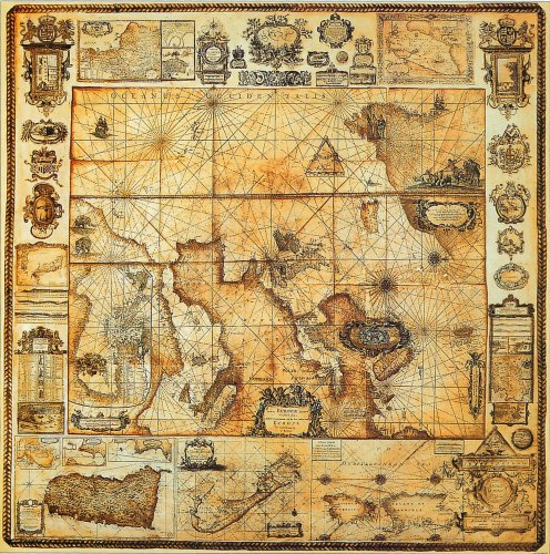
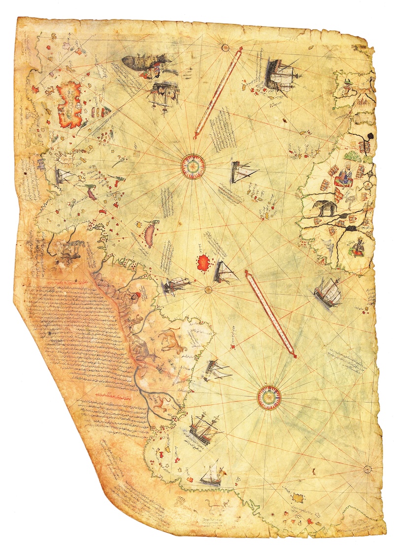
Piri Reis 1513
cm.90x63
Piri Reis 1513
cm.90x63
- Disponibile in 48 ore
- Possibilità di reso entro 10 giorni lavorativi
- Transazione sicura con carta di credito, Paypal o bonifico bancario
- Spedizione tracciata con SDA
The Piri Reis map is a pre-modern world map compiled in 1513 from military intelligence by the Ottoman admiral and cartographer Piri Reis. It is one of the oldest maps showing the New World. The historical importance of the map lies in its extent of exploration of the New World by approximately 1510, and in its claim to have used Christopher Columbus's maps, otherwise lost, as a source. The map was discovered in 1929, at the Topkapi Palace in Istanbul, by Gustav Adolf Deissmann. He had been commissioned by the Turkish Ministry of Education to catalog the Topkapi Sarayi library's non-Islamic items. At Deissmann's request to search the palace for old maps and charts, the director Halil Edhem found some disregarded bundles of material, which he handed over to Deissmann. Realizing that the map might be a unique find, Deissmann showed it to the orientalist Paul Kahle who identified it as a map drawn by Piri Reis.
Autore
Ean / Isbn
80024623