Sailing directions for the South & West coasts of Ireland
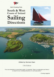
Sailing directions for the South & West coasts of Ireland
- Disponibile in 7 giorni
- Possibilità di reso entro 10 giorni lavorativi
- Transazione sicura con carta di credito, Paypal o bonifico bancario
- Spedizione tracciata con SDA
Covers from Rosslare west to Mizen Head and north to Bloody Foreland, by way of Cork, Baltimore, Bantry Bay, Dingle, the Aran Islands, Connemara, Clew Bay, Sligo and Donegal. 156 colour plans. 144 aerial and 688 sea level photographs. Text completely revised in respect of navigational aids facilities and shoreside amenities. Describes 330 ports, harbours and anchorages including 19 previously unpublished, also 13 passages documented for the first time. Five new harbours and marinas, and 150 changes to navigational aids since 2008. The standard work on small-craft pilotage of these coasts.